// Sample database of addresses with their corresponding latitude and longitude const addressDatabase = [ { address: "Address 1 Wilmac Geomatics Ltd", latitude: 37.7749, longitude: -122.4194 }, { address: "Pipers Meadow", latitude: 34.0522, longitude: -118.2437 }, { address: "Address 3", latitude: 40.7128, longitude: -74.0060 }, // Add more addresses with their latitudes and longitudes as needed ]; // Function to calculate the distance between two coordinates using the Haversine formula function calculateDistance(lat1, lon1, lat2, lon2) { const R = 6371; // Earth's radius in kilometers const dLat = (lat2 - lat1) * (Math.PI / 180); const dLon = (lon2 - lon1) * (Math.PI / 180); const a = Math.sin(dLat / 2) * Math.sin(dLat / 2) + Math.cos(lat1 * (Math.PI / 180)) * Math.cos(lat2 * (Math.PI / 180)) * Math.sin(dLon / 2) * Math.sin(dLon / 2); const c = 2 * Math.atan2(Math.sqrt(a), Math.sqrt(1 - a)); const distance = R * c; // Distance in kilometers return distance; } // Function to find the nearest address in the database to a specified address function findNearestAddress(specifiedAddress) { // Convert the specified address to latitude and longitude using a geocoding service/API // For this example, let's assume the specifiedAddress has already been converted to latitude and longitude // Sample specified address (latitude and longitude) const specifiedLatitude = 37.7749; // Replace with the latitude of the specified address const specifiedLongitude = -122.4194; // Replace with the longitude of the specified address let nearestAddress = null; let nearestDistance = Number.MAX_VALUE; for (const addressEntry of addressDatabase) { const distance = calculateDistance( specifiedLatitude, specifiedLongitude, addressEntry.latitude, addressEntry.longitude ); if (distance < nearestDistance) { nearestDistance = distance; nearestAddress = addressEntry.address; } } return nearestAddress; } // Usage example const specifiedAddress = "Your specified address"; const nearestAddress = findNearestAddress(specifiedAddress); console.log(`The nearest address to ${specifiedAddress} is ${nearestAddress}.`);
IMG 5641

Boundary surveys are one of the surveys we carry out the most, after topographical surveys.

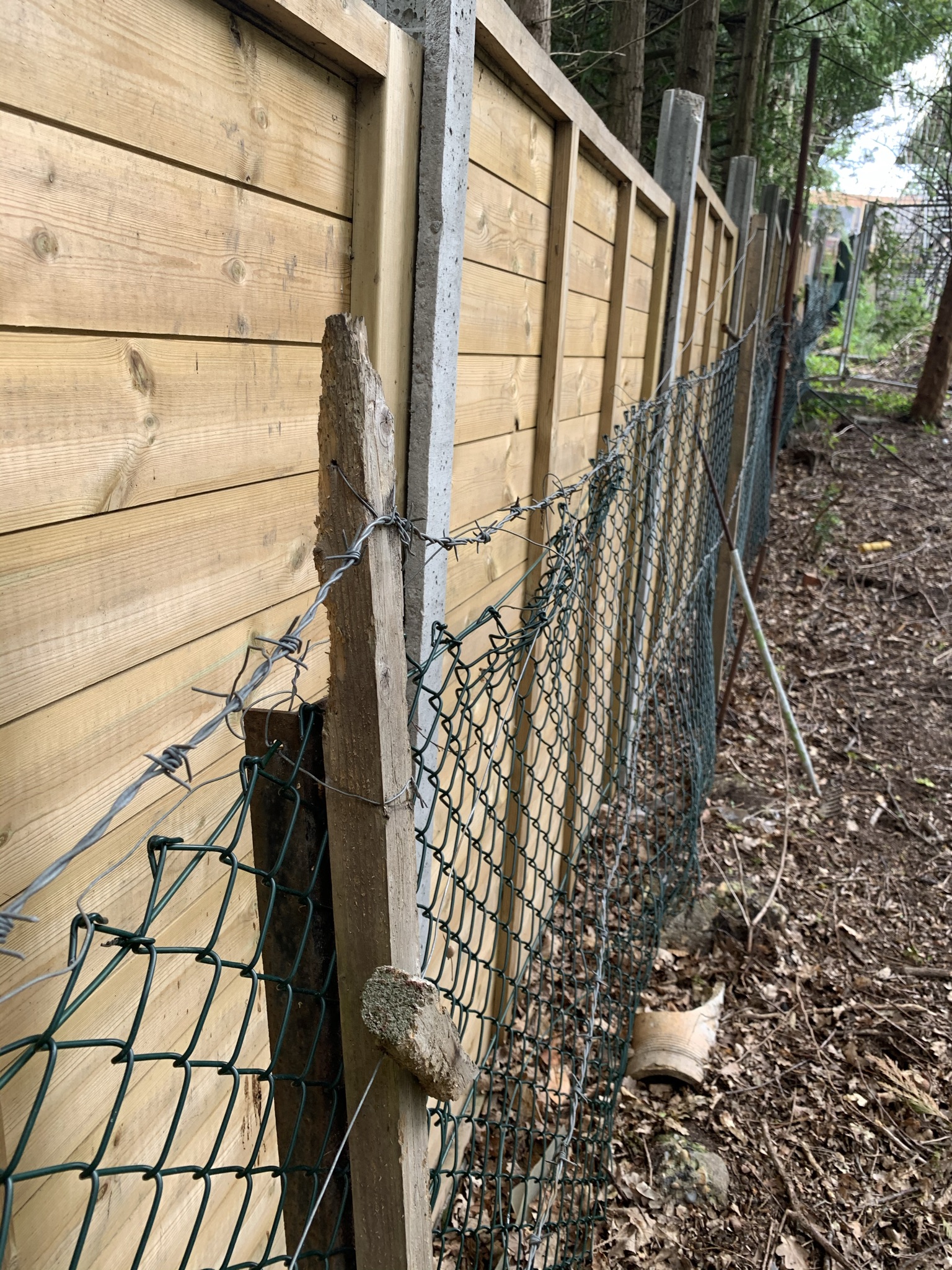
These surveys are carried out for a number of reasons which include the sale or transfer of land, clarification of where a fence or wall should be positioned, or a boundary dispute between neighbours. 

A boundary dispute can arise when two or more parties disagree on the position or extent of a boundary that separates their properties.

There are several ways that a boundary dispute can occur. For example, one party may build a structure that encroaches on the other party’s land, or a neighbour may claim a portion of land that the other party believes is theirs. Sometimes, boundary disputes arise due to unclear or ambiguous descriptions in title deeds or land registry plans, or as a result of changes in the landscape over time.

We create reports and plans to resolve a boundary disputes and will work with other appointed surveyors to resolve disputes. In many cases simply opening up communications between both parties can resolve a dispute, however sometimes mediation, or  legal action maybe required. We endeavour to determine the precise location of the boundary line with the information available, we’ll research historic mapping, reports and photographs. 


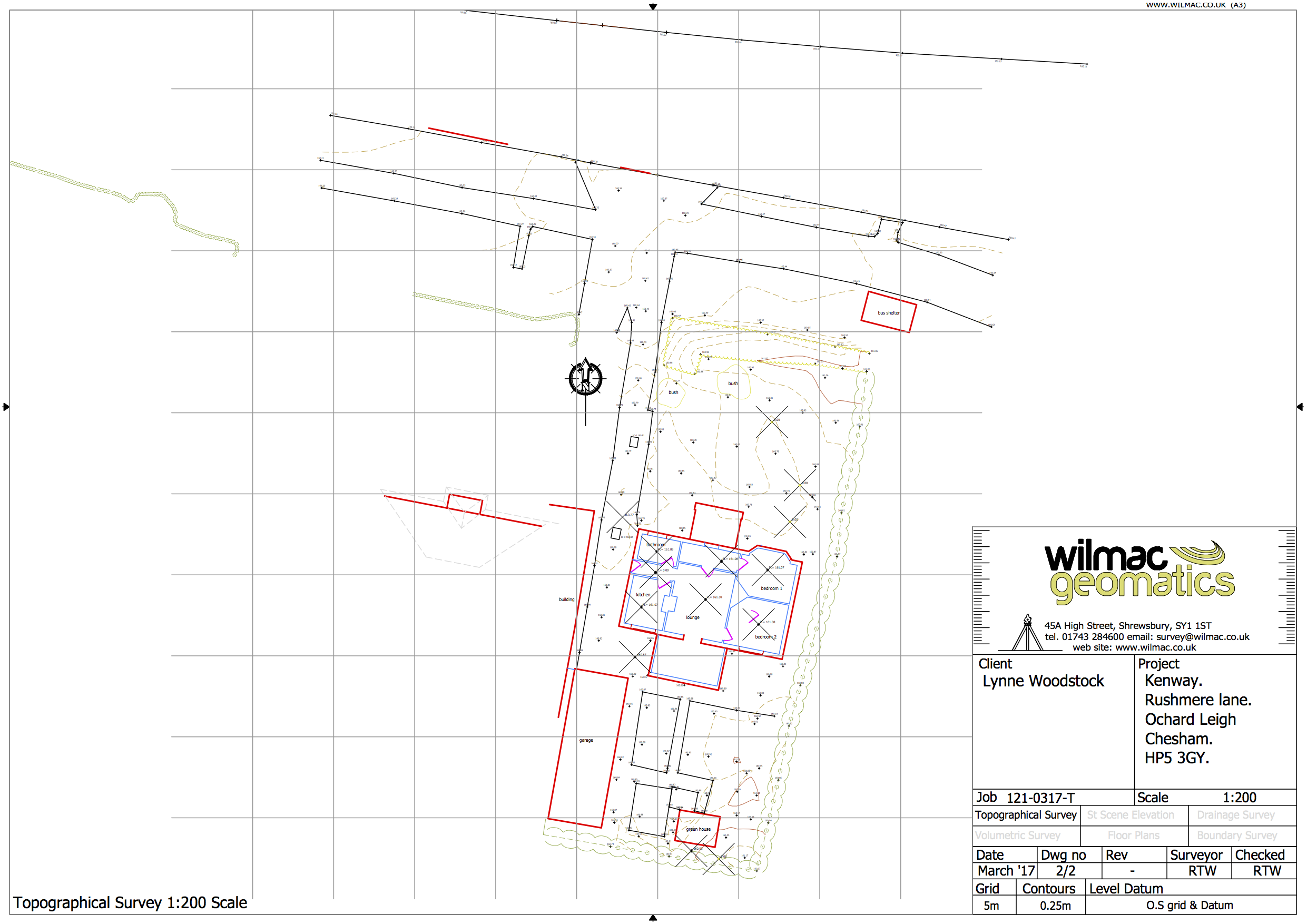
Topographical Survey: How topography affects the design.
For more information click here.

10 Topographical Self builder

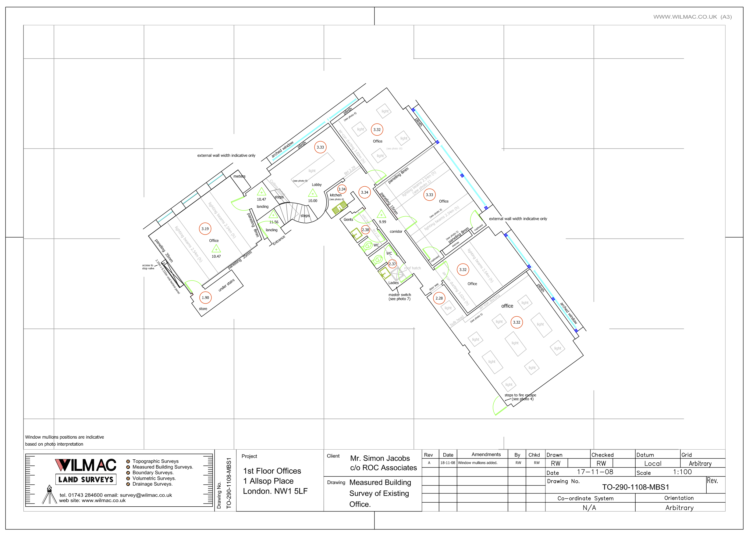
Measured Building Surveys (floor plans): for any property to be removed or included For more information click here.

11 Floor Plans for self builder 1 1

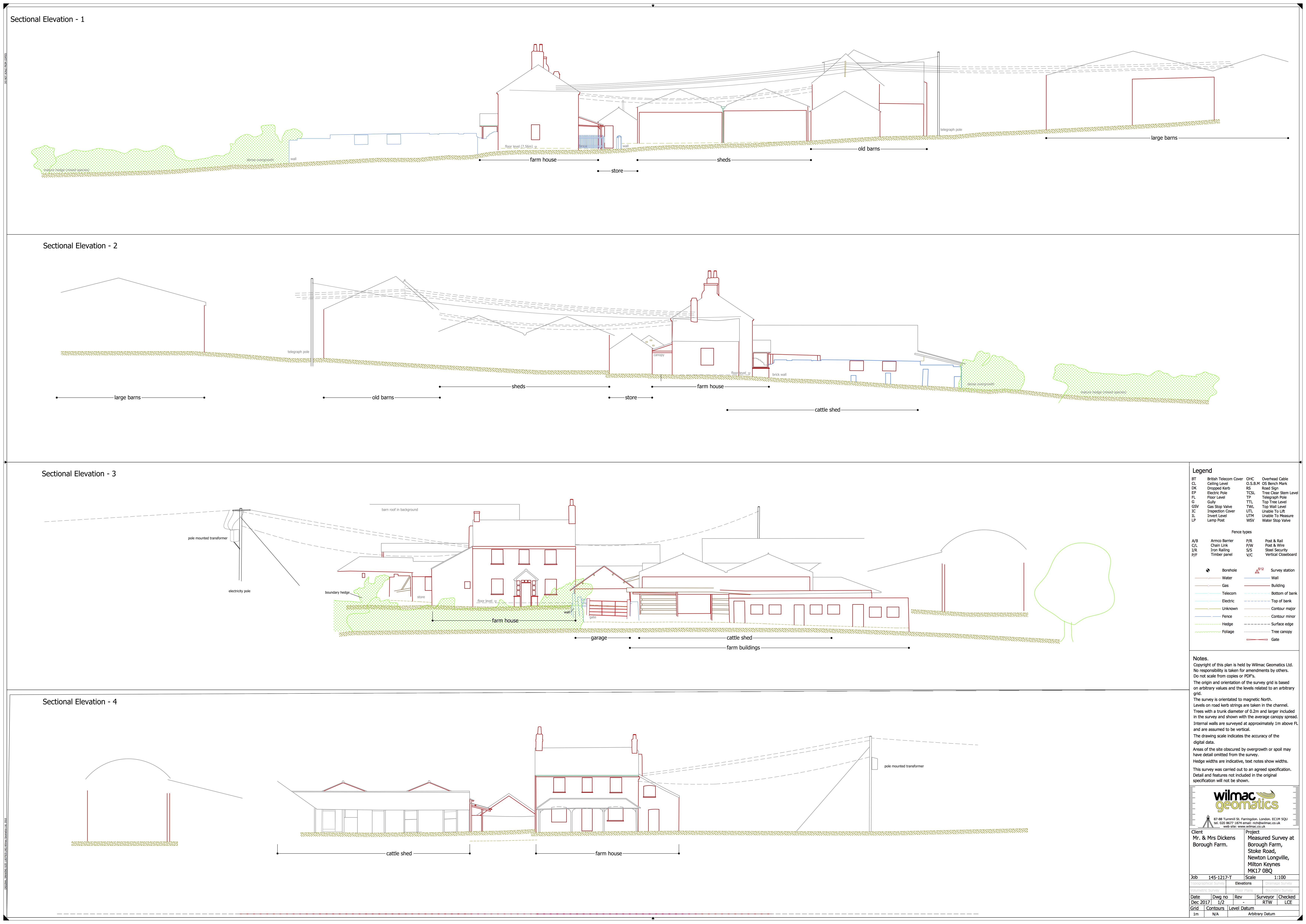
Street Scene Elevations: to demonstrate the interface of neighbouring properties
For more information click here.

12 Street Scene

Drainage Survey: you’ll need to know where the waste and the rain flows too. 
For more information click here.


Talk to us about your project

×