
About Us.
Land Surveying and Measured Building Surveys.
Established in 2003 by Richard Wills a land surveyor with 30 years’ experience. Wilmac has worked with Property Developers, Self-builders and Architects on projects throughout the U.K. and beyond.
We’ve been involved with many interesting projects, including:
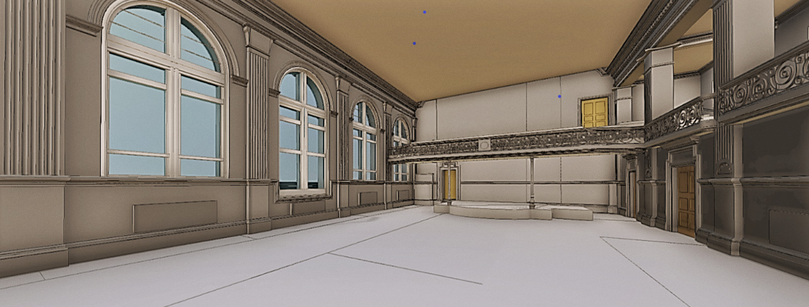
Complete measured survey of a new development on Gresham street near St Pauls, London. We installed a comprehensive control network that linked the internal floors and basement onto the roof and down to street level. The land surveying was linked to the Ordnance Survey national grid coordinate system using differential GPS. In total Wilmac established 124 control stations and 135 laser scanning targets with a misclosure of less than 2.5mm (vector). The control was then used to scan the entire building using Leica RTC360 & C10 long range scanners. Once the scanning was completed Wilmac returned to set out grid lines on all floors for the re-fit work. All of the work was carried out during the early stages of the Covid pandemic which added complexity to the site activity. 
Boundary dispute, Kingston upon Thames. Our client had been developing a site for a few years. During the major construction phase our clients neighbor chose to carry out some extension work themselves. The boundary fence was removed to accommodate the neighbors garage construction, when the fence was re-established it was apparent that it had not been erected in the same place. Luckily the original topographic land surveying included the original fence line, with a digital version of the land survey Wilmac was able to demonstrate where the fence line was supposed to be. The neighbour then excavated the ground to the front of the new garage and built a substantial retaining wall. Although the face of the wall at ground level was clearly within the neighbours property, the width of a wall capable of supporting 2 meters of earth was clearly going to breach the boundary line. Wilmac created 3d CAD drawings, land survey plans and set-out pegs and markers for our client who was very happy with our service.
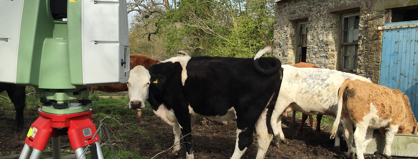
Mid-Wales BIM model. Wilmac was asked to survey an existing house and grounds that our client wanted converting into a model (BIM). We used total stations, laser scanner, drone and GPS kit to survey the house and grounds that extended to 3.5 acres. The model was required as the building was to be modified to a Passivhaus standards and the landscaping would be used to demonstrate the existing and proposed layouts. The site was in an extremely remote part of Mid-Wales and a large lakes formed part of the landscape. Once complete the land survey drawings and BIM model were submitted to the client who has since used Wilmac to survey various other sites.
- We aim to convey information clearly and concisely, whilst being mindful of the purpose.
- Clearly understand the project and go the extra mile whilst being friendly and professional.
- Use land surveying equipment that achieves the best results and understand the limitations.
"understanding the first principles of land surveying and knowing how to apply those to every survey"
Richard Wills - Director